

Part 02
Plot register and Plot check
Every plot you hold, checked against the geometry rules TRACES enforces.
Plot register
Plots and producers › Plot register
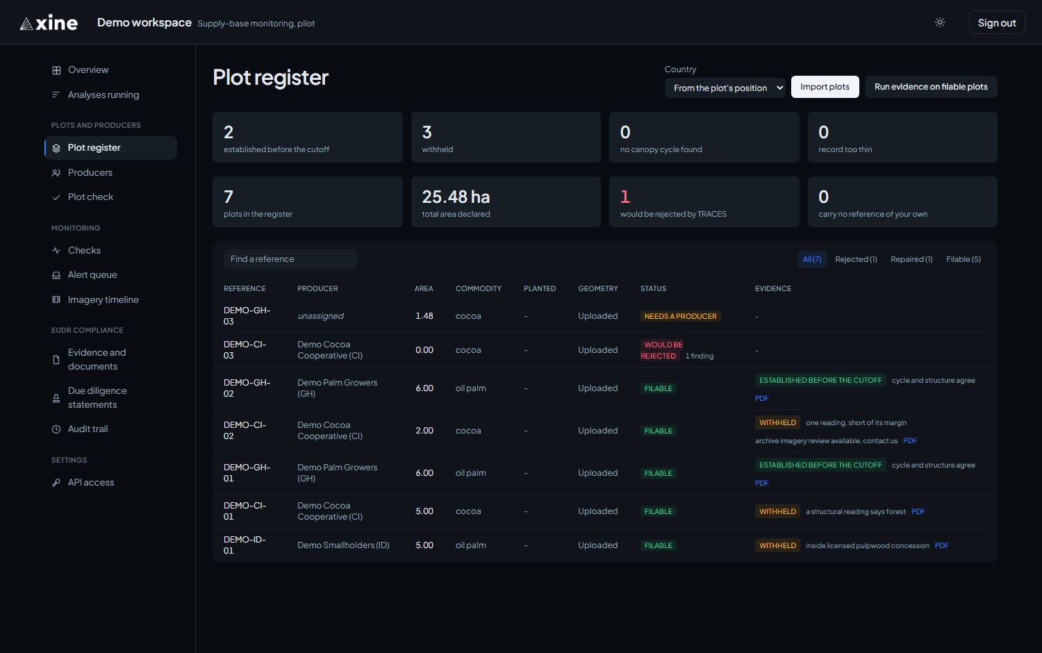
Your plots, one row each, one hundred to a page, with search by reference. The tiles above the table show the plots in the register, the total declared area, the plots TRACES would reject, and the plots with no reference of your own.
The columns
| Column | What it shows |
|---|---|
| Reference | Your ref for the plot. Click it to open the plot's page. |
| Producer | The producer the import attached, or unassigned. |
| Area | The declared area in hectares. |
| Commodity | From the commodity column. |
| Planted | From the planted_year column. |
| Geometry | Where the boundary came from: a GPS walk, drawn, uploaded, or a declared point. |
| Status | Filable, Repaired, Would be rejected or Needs a producer, with a count of findings. |
| Evidence | The verdict, its reason in words, any marks described below, and the PDF link. |
Marks in the Evidence column
Two extra marks can appear beside a verdict.
- N% forest loss after cutoff means the Landsat record dates moist-forest loss on part of the plot to 2021 or later. The evidence document states it under the finding; see Moist forest loss dated after the cutoff.
- archive imagery review available, contact us appears on plots under 4 ha. For those plots the open satellite record is supporting evidence, and a review of archive imagery dated before the cutoff is the route to a firmer answer.
When a boundary changes
If you re-import a plot whose boundary has changed, its evidence is withdrawn because it described the old boundary. Press Run evidence on filable plots again to read the new one. Reading a plot a second time over an unchanged boundary is done through the API; see API access.
The plot page
Plot register › a reference
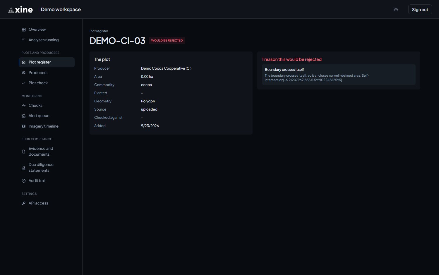
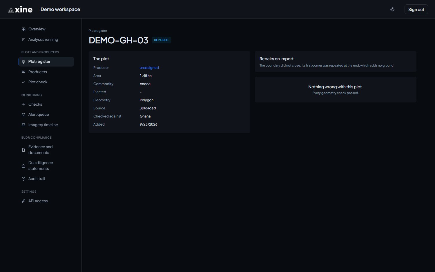
Clicking a reference opens the plot's page. It shows the plot's details (its producer, area, commodity, planting year, geometry, source, and the country it was checked against) beside the geometry findings: every reason the plot would be rejected, every warning, and every repair made on import. Evidence and the PDF are on the register row.
Plot check
Plots and producers › Plot check
A dry run of the geometry checks: upload a file and read the report, with nothing stored. It takes the same files as the register import.
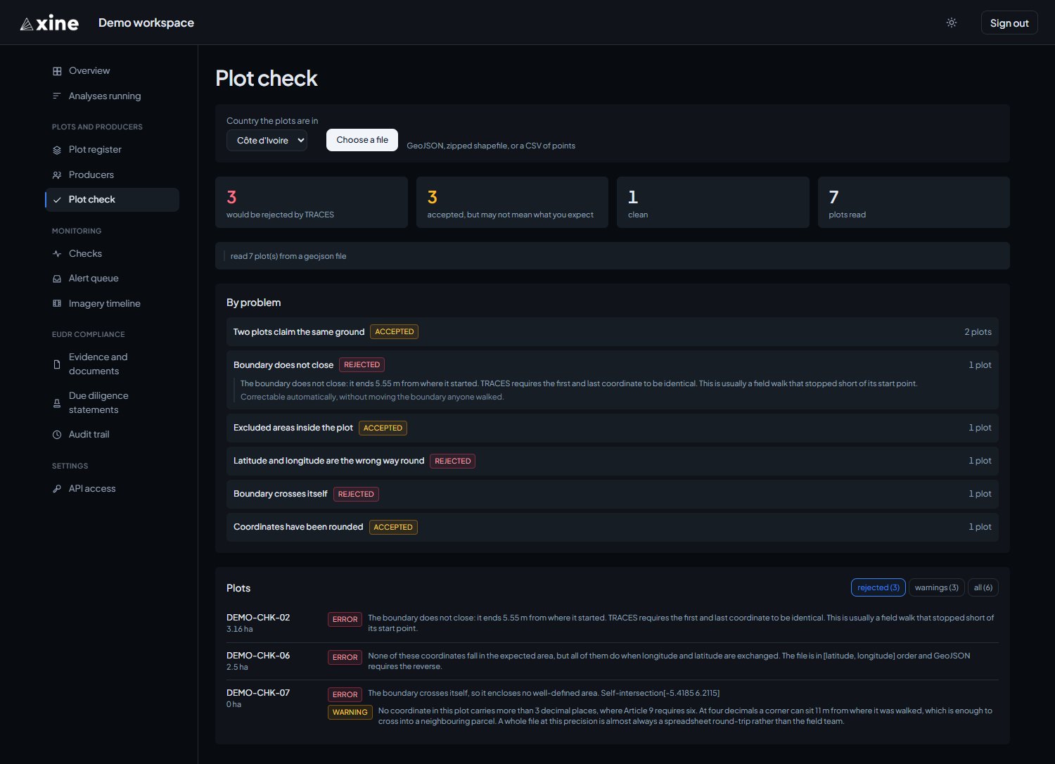
The Country the plots are in picker starts on Côte d'Ivoire, so change it to where your plots are before pressing Choose a file. Not listed skips the check for latitude and longitude written the wrong way round.
The report
The report gives four counts:
- would be rejected by TRACES
- accepted, but may not mean what you expect
- clean
- plots read
Below the counts come any notes about the upload, the problems grouped under By problem with a count each, and a per-plot list under Plots. Click a problem to read what it means.
| Marked | It means |
|---|---|
| rejected | TRACES refuses the submission. |
| accepted | TRACES takes it, but the filing may describe different ground from what you intend: for example, excluded areas inside a plot, or two plots claiming the same ground. |
| Correctable automatically | Repaired on import without moving the boundary. |
The problems it looks for
Each problem is named on screen in these words.
- Boundary does not close
- Boundary crosses itself
- Coordinates are not on Earth
- Latitude and longitude are the wrong way round
- Too few corners to enclose anything
- A point was given for a plot over 4 ha
- No geometry at all
- Geometry is empty
- Coordinates are not a list of positions
- Geometry type cannot be filed
- Geometry could not be read
- Coordinates have been rounded
- Excluded areas inside the plot
- Two plots claim the same ground
- Outside the expected country