

Part 02
Explore
Finding your ground and seeing what has already flown over it.
Explore is the front door. It answers two questions: where is the ground, and what has already flown over it. Nothing is priced here and nothing runs.
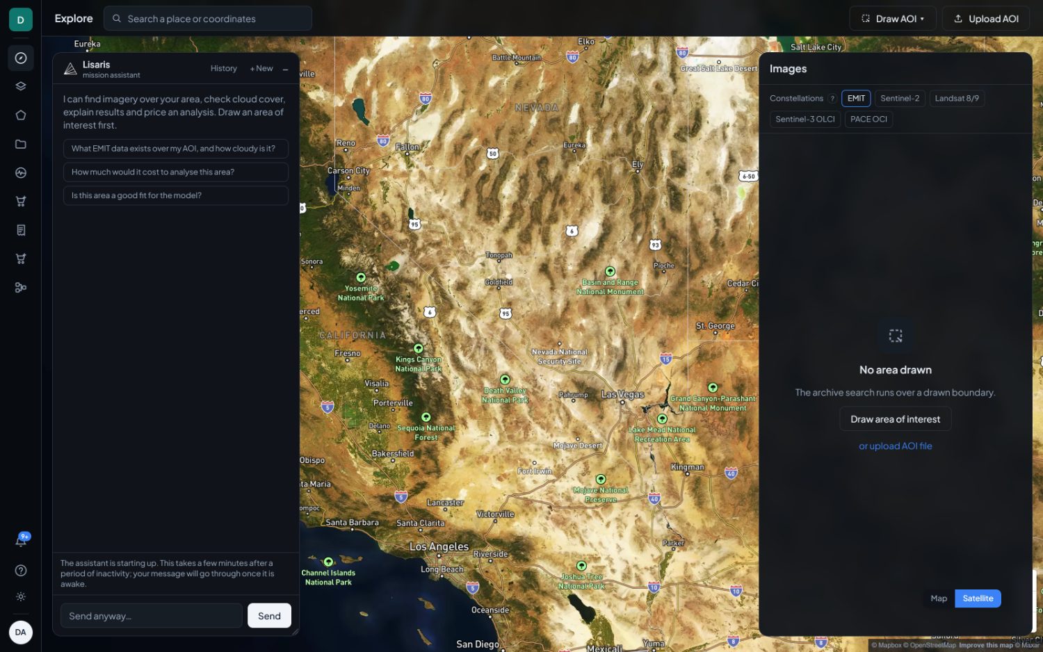
Getting to your ground
Explore › Search a place or coordinates
Type a place name and pick from the results, or paste a coordinate directly. Decimal degrees and degrees-minutes-seconds both parse, in either order, latitude first or longitude first. The box shows how it read what you typed before you commit to it.
A result moves the camera and does nothing else. An area is never drawn from a geocoder's bounding box. Those boxes are the extent of an administrative region, often thousands of square kilometres, and quietly handing you a priced area you did not draw is not something the studio does.
Drawing an area
Explore › Draw AOI
- Rectangle takes two clicks, on opposite corners.
- Polygon takes one click per corner, then a double-click to close it.
- The area in km² updates as you draw, before you commit to anything.
Upload AOI takes a KML or a shapefile if you already hold the boundary. This is the right path for a licence block, a concession or a plot register. What you upload is what gets measured, to the vertex.
Sizes that matter
| Limit | Value | Applies to |
|---|---|---|
| Tasked capture minimum | 100 km² | Commissioning a new capture. Below this no supplier will quote. |
| Standard plan area | 5,000 km² | The largest single analysis on the free plan. |
| Professional plan area | 20,000 km² | See Plans and credits. |
| Enterprise plan area | 100,000 km² | See Plans and credits. |
When you finish drawing, the save dialog offers a name, pre-filled with a timestamp you should replace, and an optional project to file it under. Naming areas properly pays off immediately, because the name follows every result, every monitor and every comparison built from that boundary.
The Images panel
Explore › Images
With a boundary drawn, this lists every scene that covers it, newest first, each with the date the satellite saw the ground and how cloudy it was. Hovering a card outlines its footprint on the map. Selecting one draws its quicklook over the true footprint, which for most sensors is a tilted parallelogram rather than a north-up box.
Searching and previewing every free archive costs nothing on any plan, signed in or not.
Constellations
The row of buttons at the top of the panel decides which archives are searched. It also decides what you will be able to measure later, so choose it for the question rather than for the picture.
| Constellation | Ground sample | Use it for |
|---|---|---|
| EMIT | ~60 m | 285 contiguous bands from 380 to 2500 nm. The only sensor here that can identify a mineral rather than notice that something absorbs. Methane, mineralogy and spectral inspection. |
| Sentinel-2 | 10 m | Sharpest and most frequent. Red-edge crop health, water extent, and anything where the shape on the ground is small. |
| Landsat 8/9 | 30 m | The longest archive and the only thermal band. Surface temperature, evapotranspiration and decade-scale work. |
| Sentinel-3 OLCI | 300 m | Coarse and near-daily. Open water and large-scale colour. |
| PACE OCI | ~1.2 km | Hyperspectral ocean colour. With OLCI, the only source publishing water-leaving reflectance, which every water-quality layer is defined on. |
Sentinel-2's shortwave band is 180 nm wide. An absorption depth measured across a window that wide is not a mineral identification, so the catalogue marks those layers Limited by band width rather than running them and letting you assume otherwise. This is the most common reason a layer you expected is not offered.
Lisaris, the assistant
Explore › Lisaris
The panel on the left of Explore. It can search imagery over your area, report cloud cover, explain a result you have open, and price an analysis before you run it. Three starters are offered on an empty conversation: what EMIT data exists over the area and how cloudy it is, what an analysis of the area would cost, and whether the area is a good fit for the model.
- History lists earlier conversations.
- + New starts a fresh one.
- The dash collapses the panel without ending the conversation.
The assistant runs on a GPU that scales to zero when idle. If it has been quiet, the composer says so and offers Send anyway. The message is queued and answered once the model is awake, usually within a few minutes. That state is reported before you type rather than after you have waited for a reply that was never coming.
Where a reply proposes something that costs money, it arrives as an explicit confirmation carrying the price, not as a sentence you have to interpret. Nothing is ordered without that confirmation.